Unmanned Surface Vessels (USV) and Unmanned Aerial Vehicles (UAV) are increasingly being used to collect geospatial data in dangerous and difficult to access areas. Historically manned vessels have been used to complete these surveys, while above drying heights RTK GPS data has been collected by a surveyor on foot. This presents often needless hazards to the surveyor, whether it be from heavy plant operations, uneven surfaces, or environmental hazards such as quick sand and sinkholes.
This paper posited a USV mounted acoustic sonar system could achieve a similar accuracy interim dredge survey, at significantly lower cost and far more safely, than a conventional manned vessel. Furthermore, the same benefits could be achieved above drying heights using Sfm (Structure From Motion) Photogrammetry utilizing UAV drones instead of conventional RTK GPS.
In order to test the hypothesis, an intertidal area was first surveyed using a Trimble SPS930 Robotic Total Station to establish a highly accurate reference DTM. A further survey was completed using an RTK GPS system. UAV drone photogrammetry was then deployed, followed by USV SBES at high water in order to allow a comparison between the systems and the reference DTM to be made.
Both the USV and UAV methods were comparable in accuracy to the RTK and reference surveys. Due to the minimal difference shown between the DTM’s of the remote sensing techniques and the reference DTM, it is clear that the speed, high data resolution, and safety advantages of the remote sensing techniques present a significant advantage. By removing the need for the surveyor to enter the survey area any risk of injury or incident is minimalized significantly. Additionally, advances in drone ‘swarm’ technology presents an intriguing avenue of additional efficiency savings, and may soon see USV’s and UAV’s operating in synchronization via a single control system.
Adam Howell

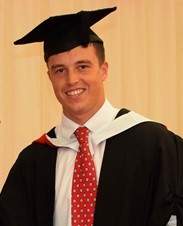
Adam Howell is a 2019 Cardiff University Marine Geography Graduate previously employed by Boskalis Westminster. Adam initially developed an interest in the capacity of remote survey technology and land reclamation in 2017, while taking part in a ‘sandwich year’ placement as a Junior Surveyor for Boskalis. This time was spent primarily on the Dover Western Docks Revival project, and formed the basis of his undergraduate dissertation as well as being the focus of this article. Adam is a keen rugby and cricket player in his spare time.
